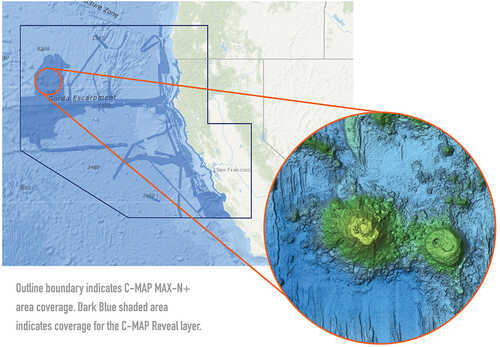
Reveal - US Pacific - North California to South Oregon Point Sur CA to Cape Blanco ORPerfect for fishing and diving enthusiasts, C-MAP® Reveal charts deliver ultra, high-resolution images of structure, wrecks, isolated reefs and ledges on the sea floor, plus full navigation capability – all at a more affordable price than other charts in its category. Features:High-definition C-MAP Reveal layer for selected coastal and offshore areasReduces search time with immediate high-definition display of bottom structure, wrecks, isolated reefs and ledges11 local charts for U.S. coastal areaC-MAP Reveal maps available on SD cardEasy to use – simply turn on Shaded Relief setting in chartplotterC-MAP Reveal charts contain full C-MAP MAX-N+ vector navigation data, including new features like High Res Bathy, Custom Depth Shading, Genesis layer and satellite imageryIncludes detailed marina and port plansCompatibility:LowranceHDS GEN 2HDS CarbonHDS LiveHDS GEN3ELITE TI2SimradGO XSE / GOXSRNSS/NSO evo3NSS/NSO evo2B&GZeus 3Zeus 3 Glass HelmZeus 2Zeus 2 Black BoxVulzon 12Vulcan 7 (rematch)Vulcan 9 SeriesVulcan 7 FSVulcan 5 Series
There are no reviews yet for this item.


